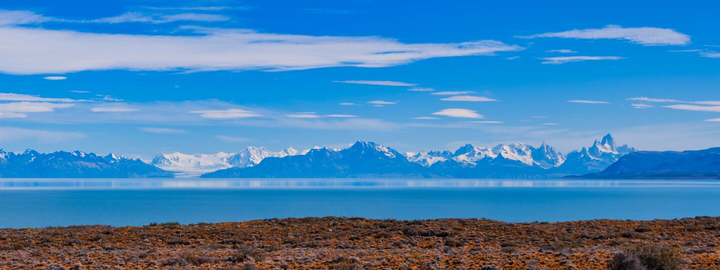
The vast steppe
Route 41 as you arrive in or leave El Chaltén
Endless plains and sky where it is hard to take your eyes off Fitz Roy!
No need to plan it separately: it is the same road you drive when arriving in or leaving El Chaltén, so just set off with time to spare and stop wherever something catches your eye.
The road across the steppe
- 90 kmfrom Route 40 to town
- Pavedall the way
- On arrivalor departure
When you arrive in El Chaltén and when you leave, you will drive Provincial Route 41, which crosses the steppe at right angles to the Andes and skirts the huge Lake Viedma. The horizon is vast on this arid plain: 360-degree views that, from some high points, reach 100 km or more.
As you approach the mountains, to the west, you start to make out the glaciers and granite peaks that made this corner of the Andes the icon of Patagonia. Coming from El Calafate, Mount Chaltén (Fitz Roy) can already be seen at the start of National Route 40, some 140 km away as the crow flies. And if the weather was not on your side when you arrived, you will get a second chance when you leave.


Before you go
- Fuel: fill up before you set off. Between Route 40 and El Chaltén the only fuel point is the YPF MAS, 1.2 km from town, usually open from 8 am to 8 pm in season.
- Wildlife on the road: guanacos and rheas cross without warning, especially at sunrise and sunset.
- Wind: open the doors carefully, because a gust can rip them out of your hand.
- Only park on wide verges and at viewpoints, never on bends or on the road.
- Bends near town: from the bridge over the De las Vueltas river, the road winds up and down with blind bends and crests.
Kilometre by kilometre

These are the points of interest along the last 45 km, approaching town:
- 42.6 km26.5 miEstancia Santa Margarita. Like a small oasis on the steppe, its lagoons and streams are home to many bird species: upland geese, several kinds of ducks, black-necked swans and two-banded plovers, among others.
- 41 km25.5 miEstancia San Lorenzo. A seepage lagoon forms by the road (it disappears in winter), where you can see Chilean flamingos and other migratory birds that feed on the lake and wetlands.
- 15 km9.3 miViedma Glacier viewpoint. The glacier has retreated so much that today you can only just make it out in the distance, much smaller than only a decade ago, but the viewpoint keeps its name. From here to National Route 40 the road runs almost straight, with several viewpoints over the lake and the range, where Mount Fitz Roy stands out.
- 14.1 km8.8 miBridge over the Barrancas river.
- 12.7 km7.9 miBridge over the De las Vueltas river. From here to town the road leaves the straight stretch and winds along the valley, with rises and dips that often hide the road ahead: drive carefully.
- 11.7 km7.3 miEntrance to Los Glaciares National Park. From here on, the roadside viewpoints.


Drive carefully: guanacos cross the road without warning, and the wind can push the car on the open stretches.
Flora and fauna along the road
What sets this stretch apart is the wildlife, which is much easier to see on the open steppe than in the forest. These are just some of the plants and animals you may come across.
The steppe
- Coirón grasses: the tough tussock grasses that give the steppe its golden colour.
- Mata negra and neneo: low, stunted shrubs, adapted to wind and drought.
- Calafate: the thorny shrub with yellow flowers and purple berries that gives its name to the neighbouring town.
- Flowers: in spring, flowers such as the desert amancay or the evening primrose (Don Diego de la noche), which opens its flowers at dusk, peek out among the shrubs.
The animals
- In the open country: guanacos, lesser rheas (choiques), grey foxes, skunks and pichi armadillos.
- In the lagoons and wetlands: ducks, flamingos, swans and upland geese.
- In the air: condors and raptors such as caracaras, black-chested buzzard-eagles, American kestrels and hawks.
- On the estancias along the road: flocks of sheep, cattle and horses.
Frequently asked questions
Updated: November 11, 2026
Yes, between National Route 40 and El Chaltén, Provincial Route 41 is paved. The gravel only begins on the other side of town, towards Lago del Desierto.
Just one, and a basic one: the YPF fuel point (Módulo de Abastecimiento Social, MAS), 1.2 km from town, with regular petrol and diesel, usually open from 8 am to 8 pm in season. Between Route 40 and that point there are no petrol stations or roadside stops.
Sunrise and sunset: with the sun low, the peaks turn red and the steppe gains depth. If it was cloudy the day you arrived, the drive back to Route 40 is a second chance to see the whole range.
It is about 215 km, almost all on National Route 40 and Provincial Route 41: around 3 hours without stops. All the options are in How to get there.
Plan your trip
- Car rides
The four car rides from El Chaltén - Roadside viewpoints
The short ride across the steppe - Bahía Túnel
Half a day to Lake Viedma - How to get there
Flights, buses and roads to El Chaltén - Buses and shuttles
Timetables and transfers - Rent a car
Car rental in El Chaltén - The weather
Temperatures, wind and what to wear


